Written by Laile Di Silvestro
Unless you are amongst those of us who can’t abide the smell of coffee, you might want as little space as possible between your coffee and its pot in the morning. If so, the dictionaries agree with you and have declared coffeepot to be a single word.
Assuming the 2024 Coffeepot Fire doesn’t necessitate the use of our “go bags,” it provides an excuse for us to pull out that coffeepot or wonder for a moment what box holds it in what corner of the garage. Nowadays, of course, some espresso aficionados might wonder what a coffeepot even is.
Our Coffeepot Fire isn’t the first. In 2003, lightning strikes lit two small Coffeepot Fires. Like those, the 2024 fire is named after Coffeepot Canyon, which is named after… you guessed it… a coffeepot.
This wasn’t just any coffeepot.
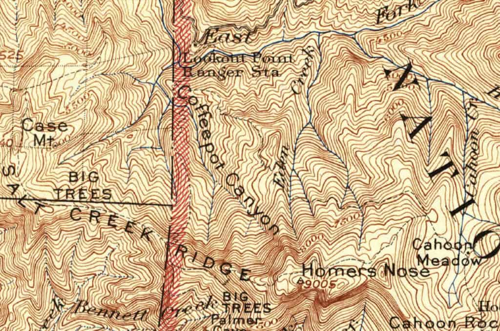
According to first-hand accounts, the Euro-Amercan settlers started exploring the Coffeepot Canyon area as early as the 1860s. The mostly fictional 1883 map depicts, but doesn’t name, the creek, and it depicts a trail heading up to Case Mountain and to a point near the headwaters of the creek. The U. S. Cavalry’s 1899 and 1900 maps clearly display the creek and show a trail heading up Salt Creek, over Case Mountain, and along the ridge to Homer’s Nose.
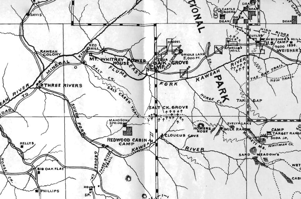
It wasn’t until 1902 that Coffeepot received official recognition. That year surveyors mapped the Kaweah Quadrangle. In 1904, the name Coffeepot Canyon was affixed to a USGS map, as well the trail up Salt Creek, over Case Mountain, along the ridge to Homer’s Nose, and thence to Hockett Meadows. Another trail ascended from Oak Grove and intersected the Case Mountain trail a little northwest of the peak.
All this might lead us to suspect that the coffeepot for which Coffeepot Canyon was named existed before 1902.
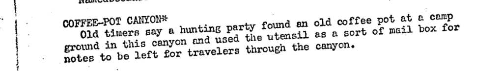
According to historian Herbert L. Junep in 1937, the coffeepot was rather important. “Old timers say a hunting party found an old coffeepot at a camp ground in this canyon and used the utensil as a sort of mail box for notes to be left for travelers through the canyon.”
If this is to be believed, a sufficient number of travelers roamed Coffeepot Canyon to make a coffeepot mailbox useful. At least two travelers, anyway.
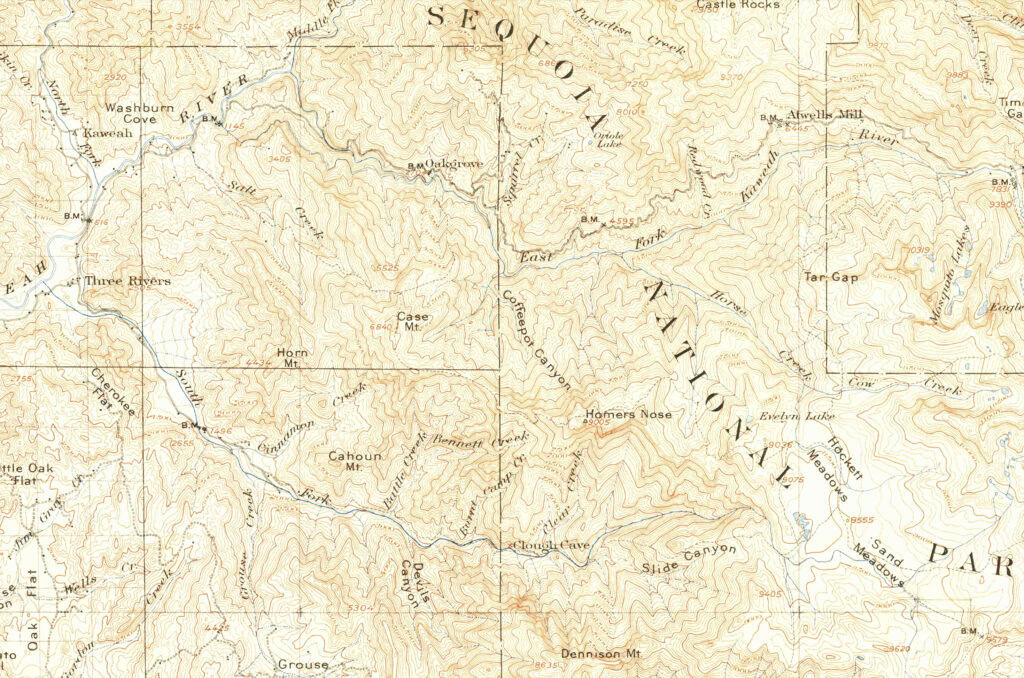
But, there could have been many more travelers. A 1934 update to the 1909 USGS map depicts a trail departing from Lookout Point, crossing the East Fork of the Kaweah River, crossing Coffeepot Canyon, and then switchbacking up the ridge just to the west of it before meeting the trail to Homer’s Nose and beyond. It even depicts what might be a structure next to one of the Coffeepot Creek tributaries.
A 1942 update depicts that trail, as well as one that branches off of it and switchbacks up the ridge to the east of Coffeepot Canyon before traversing east to Cahoon Meadow.
So, the steep inaccessible terrain through which the northern front of the 2024 Coffeepot Fire is burning was once accessible enough for mail delivery of a sort.
Sequoia National Park personnel maintained the trails until resource constraints and policy decisions precluded further upkeep. If you ask around, you’ll find some locals with excellent trail finding skills augmented by a good GPS who have walked the old trails.
For now, the slopes and the historic trails that traverse them are the fire’s domain. Somewhere, though, the remains of a coffeepot may be escaping the flames.
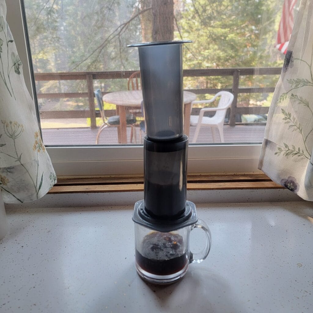
Thanks to those that shared a picture of their coffeepots from in and around Mineral King!