MK Road Corridors
The Mineral King Road Corridor
Historic Points of Interest
The First Campers
The East Fork of the Kaweah River has been used as an access route to the high country of the Southern Sierra Nevada for possibly 3,000 years. The early Yokuts Wukchumni people, who had a village below Three Rivers, claimed all the waters of the Kaweah River in their territory.
No major trade trails followed the steep East Fork canyon up to Mineral King. There undoubtedly were some early hunting and exploratory pathways, but the Yokuts chose easier trading routes to the east side of the range. One ran from Eshom Valley up the Kings River Canyon. To the south, others ran from the Poso Creek and Tule River drainages eastward to the Kern.
It wasn’t until the Western Monache Patwisha or Balwisha people moved into the higher foothills of the Kaweah River drainage around 1,000 years ago, that a trade route was developed into the Mineral King area. Even then, it did not go up the difficult East Fork canyon. Evidence indicates it ran a circuitous route up the Middle Fork, around Paradise Ridge or over Timber Gap and into the Mineral King Valley, then south over Farewell Gap to the Kern River. It never became a major trade route, but provided a summer high route to the Kern and Owens Valley. Owens Valley obsidian still can be found throughout the Mineral King Valley.
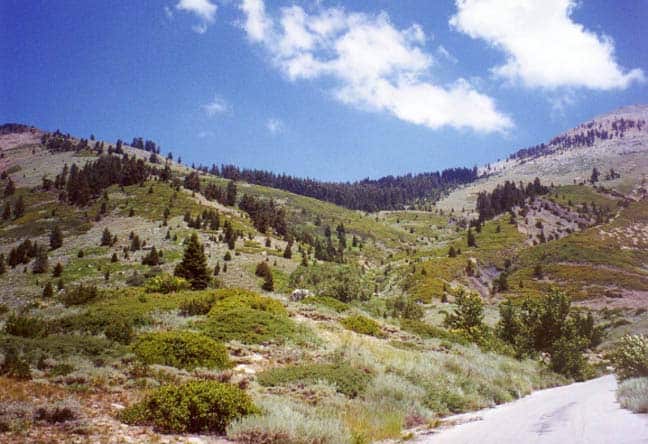
A consistent trail up the East Fork canyon probably wasn’t developed until around 500 to 900 years ago. Around that time, a warm spell gripped the California landscape with two severe droughts that lasted over 200 and 140 years each. During these drought periods the people of the foothill regions sought summer refuge in the highlands. On the Kaweah River, local Patwisha family groupings ran trails up the South and East Forks to summer camps in the coniferous forests. Prominent landmarks along the way were named, including Sawtooth Peak which they called kah-did-it.
One of the lower family camps on the East Fork was at today’s Cabin Cove where the Kaweah’s precipitous canyon rises into a fairly level area of cool, forested and creek-fed lands. Here lay respite from the summer’s oppressive heat, good hunting, and foraging for nuts, berries and tubers.
Several other camps lay along the trail that evidently wound up the canyon along today’s road corridor. There were aboriginal camp sites at Atwell Mill, Silver City, through Faculty Flats, near the current ranger station, and at Cold Springs Campground.
In the Mineral King Valley, there were campsites near the Sawtooth Trailhead on Monarch Creek, and at the old Sunny Point Campground. In the upper part of the valley, obsidian flake scatters and several arrowheads have been found in areas that apparently were hunting camps.
Each separate major camping area probably was the summer home of one extended family. Pine nuts were ground at bedrock mortar sites. Waste was piled into what have become known as middens. Obsidian acquired in trade with the Eastern Monache was shaped into arrowheads and other tools.
In keeping with their own social customs and the ancient customs of outdoor camping, we can imagine what summer life in the Mineral King area must have been for the Patwisha Indians. There would be none of the conical houses built for foothill living, though perhaps a bark lean-to might be built for protection from summer storms.
Warm clothing for the chilly mountain mornings and evenings would either be carried up the trail or manufactured on the spot. A scraper found in the Atwell Mill area tells us deer were hunted not only for food, but also for their hides. A rabbit-skin blanket was almost always a necessity. Buckskin breech clouts, shirts and skirts would be worn both for protection and some warmth.
The days would be filled with pleasant mountain activities. The women would forage for herbs, tubers, nuts and insects. They would gather wood, grind meal, make mush, cook, tend babies, and gossip. The men would hunt, fish, fashion and repair obsidian and rock weapons and tools. The children would play together and help with chores.
All would play gambling games and perhaps some ball games. They would visit each other’s campsites. Perhaps there would be races and wrestling matches. There would be tobacco-smoking and story-telling around a late afternoon campfire. There would be singing and perhaps the music of a four-holed flute and split-stick, cocoon, or deer’s ears rattles. On occasion, there might be dancing.
There would be play and bathing in the cold, clear river. There would be explorations by the children and young people and participation in the ancient game of hide-and-seek. There would be love and hurts,laughter and tears, discomforts and joys. There would be wonder and delight in the beauty of the remarkable Mineral King world.
(Information for this article was gleaned from several sources by Louise Jackson. Principal among them are: Jennings and Kisling, ARCHAEOLOGICAL RESOURCES OF THE MINERAL KING DISTRICT; Steward, INDIAN TRIBES OF SEQUOIA NATIONAL PARK REGION; Stewart, THE YOKUT INDIANS OF THE KAWEAH REGION; Gayton, YOKUTS AND WESTERN MONO SOCIAL ORGANIZATION, Heizer, TRADE AND TRAILS.)